
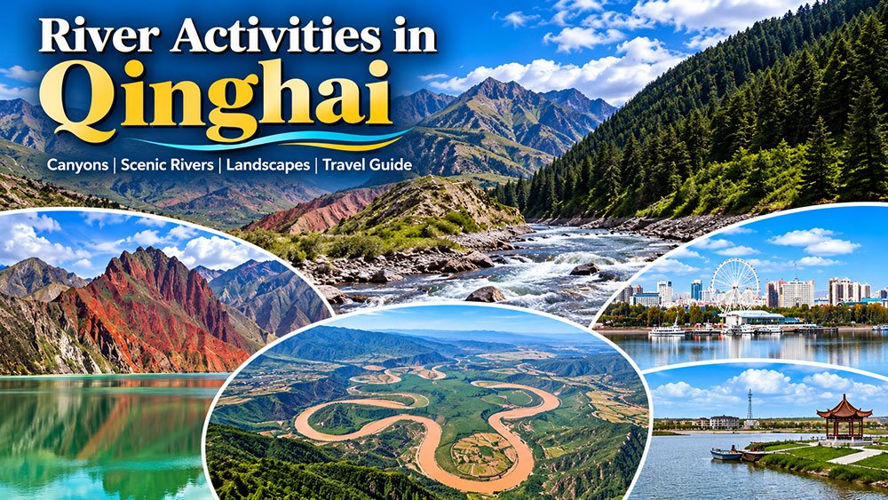
River Adventures in Qinghai: Scenic Rivers and Outdoor Experiences
Qinghai is famous for high mountains, grasslands, lakes and vast open landscapes. Its rivers add another dimension to the province, creating deep canyons, green valleys, wetlands and distinctive cultural landscapes.
For travelers, river activities in Qinghai are less about conventional water sports and more about scenic drives, photography, hiking, nature observation, cultural exploration and discovering the communities that developed along important waterways.
Three places stand out for a river-focused journey: the Heihe River Grand Canyon in Qilian, the Yellow River landscapes around Guide, and the unusual Daotang River near Qinghai Lake.
These destinations also reflect different environments. The Heihe River cuts through the Qilian Mountains, the Yellow River creates a greener valley around Guide, and the Daotang River flows in the unusual direction of east to west before entering Qinghai Lake.
Qinghai has also expanded its tourism focus in recent years. In 2026, the provincial government launched broader plans for ecological tourism, including the development of the “Clear Yellow River” tourism belt and improved tourism services around major destinations.
Why Explore Rivers in Qinghai?
Rivers are central to Qinghai’s landscapes and ecosystems.
The Yellow River begins on the Qinghai-Tibetan Plateau and flows through nine provincial-level regions before reaching the Bohai Sea. China’s official Yellow River planning documents give its total length as approximately 5,464 kilometres.
The Heihe is China’s second-largest inland river, rising in the Qilian Mountains before continuing through Gansu and Inner Mongolia. Its headwaters and surrounding glaciers are closely connected with the region’s water system.
Meanwhile, the Daotang River belongs to the Qinghai Lake water system and flows from east to west into the lake. This unusual direction helps give the river its popular “backward-flowing river” nickname.
For travelers, these waterways provide an opportunity to experience Qinghai from a different perspective.
-
Heihe River Grand Canyon

The Heihe River Grand Canyon lies in Qilian County in the Qilian Mountains of Qinghai. The river cuts through a dramatic mountain environment surrounded by grasslands, high peaks and alpine scenery.
The Heihe River itself is a major inland river of northwestern China. The river originates in the Qilian Mountains and eventually flows through Gansu and Inner Mongolia, where its water supports agriculture and ecosystems far from its high-altitude source.
A Remote Mountain Landscape
The canyon is known for its rugged scenery and relatively remote setting.
Visitors can expect a combination of:
- Mountain cliffs
- Grass-covered slopes
- Fast-flowing river sections
- Alpine vegetation
- Snow-covered peaks
- Broad valley views
- Wildlife and birdlife
The scenery changes considerably with altitude and season. Summer can bring greener hillsides and wildflowers, while autumn can produce stronger contrasts between golden vegetation and darker mountain slopes.
What to Do at Heihe River Grand Canyon
Scenic hiking
The canyon is particularly suitable for travelers who enjoy walking and exploring natural landscapes.
However, this is not a conventional urban tourist attraction with paved paths throughout. Some areas require additional outdoor experience, and visitors should check local access information before entering remote sections.
Landscape photography
The combination of water, mountains and open sky creates excellent opportunities for landscape photography.
Early morning and late afternoon can provide attractive light, while changing weather can dramatically alter the appearance of the mountains.
Nature observation
The broader Qilian Mountain region supports diverse alpine ecosystems. Visitors should observe wildlife from a safe distance and avoid disturbing animals or nesting areas.
Is the Heihe Canyon the Same as the Entire Heihe River?
No.
Older travel articles sometimes describe the canyon as stretching for hundreds of kilometres. That wording can be confusing.
The Heihe River is a long river system, while the Heihe River Grand Canyon refers to the mountainous canyon landscape in the Qilian area. Current visitor information places the main accessible canyon area around the Huangzangsi Village region rather than treating hundreds of kilometres as one continuous tourist attraction.
This distinction makes the description more accurate for modern travelers.
Getting to Heihe River Grand Canyon
The original article recommended a specific combination of buses and a long walk. That information is now too old to use as a dependable travel timetable.
Today, the practical approach is to reach Qilian County and continue by road toward the canyon area. Independent travelers should confirm local road conditions, vehicle access and any guide requirements before departure.
Because the canyon is remote, a private vehicle, chartered vehicle or organized local tour can be more practical than relying on infrequent public transport.
-
The Yellow River Around Guide

The Yellow River around Guide County offers a completely different experience from the rugged Heihe canyon.
Guide lies in Hainan Tibetan Autonomous Prefecture, southeastern Qinghai. The Yellow River passes through the county and creates a greener landscape than many visitors expect in the high-altitude province.
The area has become closely associated with the phrase “The Yellow River is clear in Guide.”
A Remarkably Green Section of the Yellow River
In the Guide area, the Yellow River flows through a valley surrounded by mountains, agricultural land and distinctive rock formations.
The landscape includes:
- Green riverbanks
- Mountain valleys
- Danxia-style geological scenery
- Farmland
- Wetlands
- Traditional villages
- Scenic river viewpoints
This is one of the easiest places to appreciate the relationship between water, agriculture and settlement in Qinghai.
The “Clear Yellow River” Tourism Area
Guide has invested heavily in developing river-based ecological tourism.
The Qingqing Yellow River Scenic Area was officially recognized as a national 4A tourist attraction in 2023. Current local plans aim to further develop the area and pursue 5A-level status. The attraction includes the Waterwheel Square, reed wetlands, riverside parks and other cultural and ecological features.
This development has changed the visitor experience considerably since the original article was published.

What to Do in Guide
Enjoy riverside scenery
One of the simplest activities is to walk, photograph or relax beside the river.
The greener surroundings make Guide especially appealing to travelers who want a break from the arid landscapes found farther west in Qinghai.
Explore local culture
The Yellow River valley around Guide has a long history of human settlement. Cultural attractions and local traditions provide opportunities to combine natural sightseeing with heritage experiences.
Visit during festival season
Guide has developed a strong calendar of tourism and cultural events.
In April 2026, Guide hosted the 20th Yellow River Culture Tourism Season, featuring 25 activities involving cultural heritage, performances, sports, food and ecological tourism.
The same event promoted spring travel experiences based around pear blossoms, non-heritage culture and the Yellow River.
For travelers, festival timing can add a cultural dimension to a river-focused itinerary.
Guide and the Future of River Tourism
The latest tourism strategy places increasing emphasis on ecological and cultural travel.
The 2026 “Clear Yellow River” tourism initiative aims to connect river landscapes with cultural heritage and outdoor experiences across Qinghai. The provincial tourism department also used the 2026 China Tourism Day program to promote the Yellow River tourism belt and related ecological destinations.
This development gives Guide a broader role in Qinghai’s tourism network.
-
Daotang River: The River That Flows “Backward”

The Daotang River is one of Qinghai’s most unusual natural attractions.
Rather than flowing eastward like many major rivers in the region, the Daotang River flows from east to west toward Qinghai Lake.
The river originates near the western side of Riyue Mountain and belongs to the Qinghai Lake water system. Local government information gives the river’s length as about 43 kilometres.
This unusual direction explains its popular name, Daotang, which can be translated as “backward-flowing river.”
Why Does the Daotang River Flow West?
The river’s unusual direction has a geological explanation.
Qinghai Lake was once connected with the Yellow River drainage system. Geological uplift around the eastern side of the lake, including the development of surrounding mountain barriers, changed the drainage pattern. The former outflow route became blocked, and water from the Daotang River eventually flowed westward into the closed Qinghai Lake basin.
This geological story is more informative than simply repeating the “backward river” legend.
The Legend of Princess Wencheng
Like many natural landmarks in Qinghai, Daotang River also has a traditional legend associated with Princess Wencheng of the Tang Dynasty.
According to the popular story, Princess Wencheng missed her homeland while traveling toward Tibet. Her tears formed the river as she crossed the mountains.
The legend remains an important part of the area’s tourism storytelling.
It should be treated as a cultural tradition rather than a scientific explanation for the river’s direction.

What to Do at Daotang River
See the unusual river landscape
The main attraction is the contrast between the river, grasslands and surrounding highlands.
Combine it with Qinghai Lake
Daotang River works especially well as part of a road trip linking Xining, Riyue Mountain and Qinghai Lake.
Take photographs
The broad grasslands and distant mountains offer panoramic views. Traditional costumes, local cultural displays and livestock may also appear around tourism areas.
Learn about local geography
A visit becomes more interesting when you understand why the river flows in the opposite direction from the pattern described in the old travel literature.
Daotang River and Current Transport Developments
Travel infrastructure around Daotang River continues to change.
In 2026, Qinghai’s transportation authorities continued work associated with the Daotang River–Qinghai Lake–Chaka road corridor, including the construction and renovation of service facilities at Daotang River and Erlangjian.
Official road reports also show that the routes around Daotang River, Riyue Mountain and Qinghai Lake can experience construction, maintenance, geological hazards and temporary traffic controls. A September 2026 road report, for example, noted ongoing road and bridge works and temporary traffic-management measures in parts of the corridor.
For this reason, travelers should check current road conditions shortly before driving.
River Activities in Qinghai for Different Travelers
A river journey in Qinghai does not have to mean strenuous hiking.
For photographers
The Yellow River around Guide provides greener scenery, while the Heihe canyon offers a rugged mountain environment.
For hikers
The Heihe canyon is better suited to visitors looking for a more rugged outdoor experience.
For families
Guide and the Daotang River area are easier to combine with sightseeing by road and shorter walks.
For road-trip travelers
The three destinations can form part of a broader Qinghai itinerary connecting major landscapes across the province.
For culture enthusiasts
Guide’s Yellow River festivals and local cultural attractions can add a cultural element to a river-focused trip.
River Landscapes and Qinghai’s Ecosystems
The rivers of Qinghai are not only scenic attractions. They are essential components of the region’s ecosystems.
The Heihe originates in the Qilian Mountains and carries water toward large inland ecosystems farther downstream. Recent reporting from China’s National Forestry and Grassland Administration highlighted the importance of Qilian glaciers to the Heihe system and noted concerns over glacier retreat.
The Yellow River is even more significant. Its upper reaches in Qinghai form part of a large ecological system that national policies seek to protect while supporting sustainable development. China’s national Yellow River strategy emphasizes ecological conservation and high-quality development throughout the river basin.
Travelers should therefore treat these landscapes as sensitive environments rather than simply recreational spaces.
Responsible River Tourism in Qinghai
Responsible tourism matters in high-altitude river environments.
Follow these principles:
- Carry your rubbish with you.
- Avoid polluting rivers and streams.
- Stay on established routes where possible.
- Do not disturb wildlife.
- Avoid damaging vegetation.
- Respect local communities and cultural sites.
- Follow safety barriers and local instructions.
- Do not enter fast-flowing or unfamiliar water.
Even when a river looks calm, current strength and water temperature can make entering the water dangerous.
Best Time for River Travel in Qinghai
The best time depends on the destination and activity.
Late spring and summer
This is generally the most comfortable period for outdoor sightseeing, with greener landscapes around Guide and more accessible mountain roads.
Early autumn
Autumn can provide excellent photography conditions, particularly when grasslands change color and mountain peaks become more prominent.
Winter
Winter creates dramatic scenery but also brings very cold conditions, shorter daylight hours and potentially difficult road conditions.
For a first visit, the warmer months are usually the most practical for combining multiple destinations.
How to Combine These River Destinations
A longer Qinghai road trip can connect the three environments.
One possible route is:
Xining → Riyue Mountain → Daotang River → Qinghai Lake → Chaka or other western Qinghai destinations
A second route can focus on southeastern Qinghai:
Xining → Guide → Yellow River valley → surrounding cultural and ecological attractions
Travelers who want a mountain-focused experience can head toward:
Xining → Qilian → Heihe River Grand Canyon
The best route depends on the season, road conditions and time available.
Important Travel Planning Advice
Do not rely on the exact bus numbers or journey times published in old travel articles.
Transportation in Qinghai continues to evolve, while road construction and seasonal traffic controls can affect travel times. Official Qinghai road reports regularly publish information about construction, rockfall hazards, bridge works and temporary restrictions.
Before departure:
Check current road conditions.
Confirm public-transport schedules.
Allow extra travel time.
Carry enough water and food for remote sections.
Download offline maps when traveling beyond major towns.
Check weather conditions at high altitude.
Why Explore Qinghai by Its Rivers?
Rivers reveal a side of Qinghai that travelers can easily miss.
The Heihe River shows how glaciers, mountains and inland waterways connect across the Qilian region. The Yellow River around Guide demonstrates how water supports greener landscapes, agriculture and long-established communities. The Daotang River provides an unusual example of the geological history that shaped Qinghai Lake.
These destinations also provide different types of experiences.
You can hike through a mountain canyon, enjoy a riverside landscape, photograph alpine scenery, attend a cultural festival or simply stop beside the water during a road trip.
Frequently Asked Questions
What are the best river destinations in Qinghai?
The Heihe River Grand Canyon, the Yellow River around Guide and the Daotang River are three distinctive choices for travelers interested in Qinghai’s river landscapes.
Can I swim in Qinghai’s rivers?
Swimming is not generally recommended in remote mountain and high-altitude rivers. Water can be extremely cold, currents can be unpredictable and rescue services may be limited.
Why is the Daotang River called a backward-flowing river?
The Daotang River flows from east to west toward Qinghai Lake. Geological changes around the lake altered the region’s drainage pattern and produced its unusual direction.
When is the best time to visit Guide?
Spring and summer can be attractive for green landscapes and cultural events. Guide’s 2026 tourism calendar included a major Yellow River Culture Tourism Season in spring.
Is the Heihe River Grand Canyon easy to reach?
The canyon lies in a relatively remote mountain area near Qilian. Road access and conditions can vary, so travelers should confirm local access before setting out. Current visitor information identifies the Huangzangsi Village area as the main access point.
Final Thoughts
River activities in Qinghai offer a different way to explore the province.
The Heihe River Grand Canyon provides mountain scenery and outdoor adventure. The Yellow River around Guide offers green valleys, cultural attractions and an expanding ecological-tourism network. The Daotang River combines an unusual geological story with one of the most popular road-trip corridors around Qinghai Lake.
Since the original article was published in 2013, Qinghai’s tourism infrastructure and river-focused travel programs have developed significantly. In 2026, the province continued expanding the “Clear Yellow River” tourism belt, improving road facilities and promoting ecological and cultural tourism.
The biggest change for modern travelers is the amount of current information available. Road conditions, attraction operations and seasonal events can change, so checking official information before departure is now an essential part of planning.
Whether you are interested in photography, hiking, culture or road trips, following Qinghai’s rivers can lead you into some of the province’s most memorable landscapes.
