
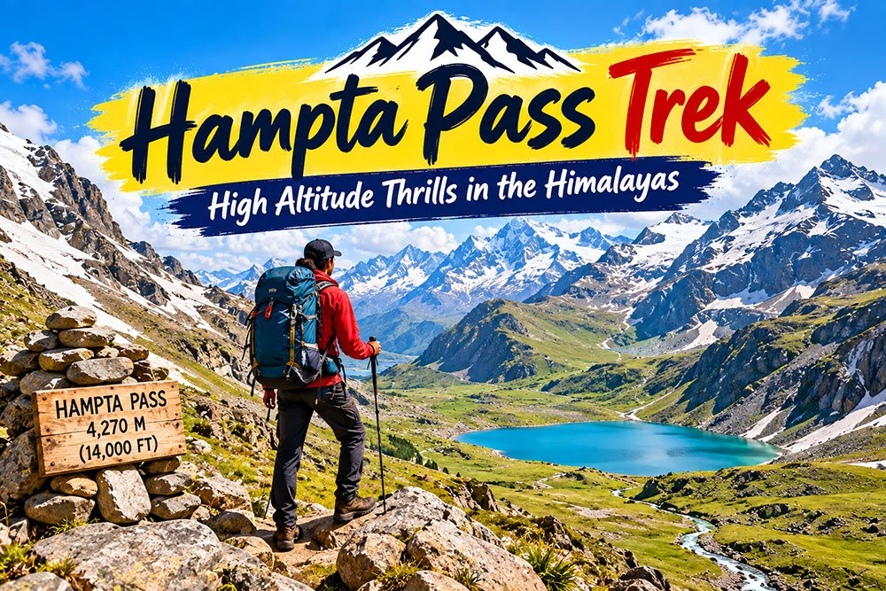
Hampta Pass Trek: Complete Guide to the High-Altitude Expedition
The Hampta Pass Trek is one of Himachal Pradesh’s most dramatic high-altitude trekking routes. The trail connects the lush landscapes of the Kullu Valley with the rugged mountain scenery of the Lahaul region. In a relatively short journey, trekkers can experience forests, alpine meadows, rocky terrain, snow patches, river crossings and the stark landscapes of the Trans-Himalaya.
The route is particularly memorable because the scenery changes quickly. One section can feel green and pastoral, while the next opens into a dry, rocky mountain landscape.
Hampta Pass stands at approximately 4,270 metres (14,000 feet) above sea level. The Government of Himachal Pradesh’s trekking portal currently lists the route as a medium-difficulty trek and includes Hampta Pass in its trekking management system.
However, altitude, terrain and weather make this a serious mountain trek. Good preparation, appropriate equipment and sensible decisions on the trail are essential.
What Makes the Hampta Pass Trek Special?
The biggest attraction of the Hampta Pass Trek is the dramatic transition between two contrasting landscapes.
On the Kullu side, the route passes through green valleys, forests and open meadows. After crossing the pass, the scenery becomes much drier and more rugged as the trail enters the Lahaul side.
Himachal Tourism lists Hampta Pass among the state’s high-altitude trekking routes and describes trekking in Himachal as an activity involving mountain paths, forests, streams, meadows and high mountain passes.
This variety makes the trek appealing to photographers, hikers and travelers who want to experience several Himalayan environments in a single expedition.
Hampta Pass Trek at a Glance
Location: Himachal Pradesh, India
Main starting point: Manali region
Pass altitude: Approximately 4,270 metres (14,000 feet)
Terrain: Forest trails, meadows, rocky sections, scree, snow and stream crossings
Difficulty: Medium on the Himachal Pradesh trekking portal; practical difficulty varies with weather, snow and trail conditions.
Typical trekking season: Generally during the warmer months when the high trail is accessible; exact opening depends on snow, weather and local conditions.
Major route feature: Crossing from the Kullu side toward Lahaul
Popular extension: Chandratal Lake, subject to road and weather conditions
Starting the Hampta Pass Trek from Manali
Manali is the usual base for the Hampta Pass Trek.
Trekkers generally travel from Manali toward the roadhead near Jobra before starting the walking section. The route then gradually moves away from the developed areas and into the mountain landscape.
The opening stages commonly feature forested terrain and green meadows. Streams and river channels become an important part of the route, particularly as the trail gains altitude.
Himachal Tourism recommends proper trekking equipment and emphasizes responsible conduct, including carrying reusable items, taking non-biodegradable waste back out and avoiding dangerous river-bank locations.
Day 1: Manali to the Trailhead and Meadow Camps
The trek typically begins with a drive from the Manali area toward the trailhead, followed by a walk through forest and meadow landscapes.
The early part of the route can feel relatively gentle compared with the pass-crossing day. Pine and other Himalayan vegetation provide a striking contrast to the open mountain terrain that appears later.
Camp locations can vary according to the trekking operator, weather and current trail conditions. Traditionally used camps in the early section include areas around Chika and Jwara.
Take the first day at a comfortable pace. The goal is not to race uphill but to conserve energy for the higher sections of the trail.
Day 2: Meadows, Streams and Balu Ka Ghera
As the trek progresses, the scenery becomes more open.
The trail follows mountain streams and alpine meadows before reaching the Balu Ka Ghera area. Depending on the season, trekkers may encounter snow patches and fast-flowing water.
The current Hampta Pass route information published by Indiahikes describes Balu Ka Ghera as a high campsite near the base of the pass and notes that snow and stream crossings can influence the difficulty of the trail.
The landscape here provides some of the trek’s most memorable mountain views.
Day 3: Preparing for the Pass Crossing
The approach to Hampta Pass becomes increasingly challenging.
The trail changes from broad meadows to rockier terrain, and the effects of altitude become more noticeable. Trekkers may encounter uneven moraine, snow and steep sections depending on the time of year.
This is a good point to slow down and focus on the terrain. Trekking poles can be useful on uneven ground, while waterproof layers and warm clothing are important even during the warmer trekking season.
Weather can also change quickly at high altitude. A sunny morning does not guarantee a clear afternoon.
Day 4: Crossing Hampta Pass
The pass-crossing day is the highlight of the Hampta Pass Trek.
The trail climbs toward the approximately 4,270-metre pass, with the final ascent becoming considerably steeper than many of the earlier sections. Indiahikes currently describes the pass-crossing stage as a moderate but demanding section involving steep climbing and descent, with the crossing reaching about 14,065 feet on its published route.
The summit provides a striking view of the landscape on both sides of the range.
From the Kullu side, the terrain appears greener and more alpine. Beyond the pass, the landscape becomes increasingly dry and rugged toward Lahaul.
The descent can be particularly demanding. Loose rock, scree, snow or wet surfaces may make the downhill section slower than expected.
Do not rush this part of the trek. Follow the route used by your guide and maintain a safe distance from unstable edges.
Entering the Lahaul Landscape
One of the defining features of the Hampta Pass Trek is the sudden visual transition after the pass.
The lush Kullu landscape gives way to the dry mountain environment associated with Lahaul. The colors become more muted, vegetation becomes sparse and the surrounding mountains take on a distinctly high-altitude character.
This contrast is one of the reasons the trek is so popular with landscape photographers.
The Government of Himachal Pradesh recognizes Hampta Pass as a route connecting the Chandra Valley in Lahaul with the Kullu side of Himachal Pradesh.
Shea Goru and the Descent
After crossing the pass, trekkers descend toward the Shea Goru side.
The route is characterized by rocky ground and dramatic mountain scenery. Depending on the season, snow and meltwater may remain on parts of the trail.
The descent may feel easier than the climb from a cardiovascular perspective, but it can be harder on the knees. Proper footwear and controlled movement are important.
Do not underestimate downhill walking.
Chatru and the Spiti-Lahaul Landscape
The route eventually leads toward the Chatru area, where the surroundings become increasingly dry and desert-like.
Chatru is often used as a road-connected base for itineraries that combine the Hampta Pass crossing with a visit to Chandratal. The exact arrangement depends on the trekking operator and road conditions.
The surrounding Lahaul landscape is especially impressive at sunset and under clear night skies.
Because the region is remote, mobile connectivity, road access and emergency support can be limited. Plan accordingly and avoid relying entirely on a mobile phone for navigation or communication.
Chandratal Lake: The Classic Extension
Many travelers combine the Hampta Pass Trek with Chandratal Lake.
Chandratal, also known as the “Lake of the Moon,” is a crescent-shaped high-altitude lake in the Lahaul and Spiti region. Himachal Tourism describes it as a clear blue lake near Kunzum Pass and notes that a road branches toward the lake from the Manali-Kaza route, while a walking approach is also possible. Its tourism information identifies summer as the main visiting period and mentions tented accommodation during the seasonal window.
Road and weather conditions can change, so visitors should verify local access before planning a fixed itinerary.
The combination of Hampta Pass and Chandratal is attractive because it adds a spectacular alpine lake experience to an already varied mountain journey.
Flora and Wildlife
The lower sections of the Hampta trail can feature alpine vegetation, grasses, wildflowers and forest ecosystems.
Wildlife sightings are possible in the broader Himalayan region, but they should never be treated as guaranteed attractions.
Do not approach, feed or attempt to photograph wildlife from unsafe distances. Himachal Pradesh’s trekking guidance specifically advises visitors not to interfere with wild animals and to avoid leaving food for them.
Responsible trekking helps protect the fragile mountain ecosystem.
The Biggest Challenge: Altitude
Altitude is one of the most important considerations on the Hampta Pass Trek.
At around 4,270 metres, the route reaches an elevation where acute altitude illness can occur. The CDC’s current Yellow Book guidance notes that unacclimatized travelers are at risk of altitude illness at much lower elevations than Hampta Pass, and that the rate of ascent is an important factor in determining risk.
Common symptoms of acute mountain sickness can include:
- Headache
- Nausea
- Dizziness
- Fatigue
- Reduced appetite
- Sleep disturbance
The Wilderness Medical Society’s 2024 clinical guidance emphasizes gradual acclimatization and recognizes acute mountain sickness, high-altitude cerebral edema and high-altitude pulmonary edema as important altitude-related conditions.
If symptoms become worse, do not continue climbing simply to complete the itinerary.
The CDC recommends never ascending to a higher sleeping altitude while experiencing altitude-illness symptoms and descending when symptoms worsen despite rest or treatment at the same elevation.
Before a high-altitude trek, travelers should discuss their individual risks and medication options with a qualified healthcare professional.
Weather and Trail Conditions
Mountain weather can change rapidly.
Snow may remain around the higher sections early in the trekking season. Rain can make trails muddy and slippery, while snowmelt can increase the force of streams and river crossings.
Recent route information from Indiahikes highlights snow, rainfall, slippery terrain and challenging stream crossings as conditions that can significantly affect the Hampta route.
That means an itinerary published online should never be treated as a guarantee of actual conditions on the day of your trek.
Before departure, check:
- Weather forecasts
- Local road conditions
- Trek accessibility
- Snow conditions
- Stream and river conditions
- Local government advisories
- Operator updates
Best Time for the Hampta Pass Trek
There is no single date range that guarantees ideal conditions every year.
In general, the trek is associated with the warmer trekking season, when snow conditions allow the pass to become accessible. Conditions can differ substantially between early and late season.
Current Hampta Pass guidance from Indiahikes describes June through September as a key trekking period, with conditions changing from heavier snow in early summer to greener landscapes and monsoon influence later in the season.
Early season
Early-season conditions can include substantial snow around the pass. The trail may be more demanding in these conditions.
Monsoon period
The Kullu side can become greener, but rainfall can make trails slippery and increase water levels at crossings.
Late season
Later in the season, rainfall generally decreases, but temperatures can drop sharply at night and winter conditions can begin returning at higher elevations.
Always confirm current trail conditions before traveling rather than relying only on historical seasonal patterns.
How Difficult Is the Hampta Pass Trek?
Himachal Pradesh’s official trekking portal currently lists Hampta Pass as medium difficulty and gives the route’s altitude as 4,270 metres.
However, difficulty can change significantly with:
- Snowfall
- Rain
- Stream levels
- Trail erosion
- Altitude
- Fitness
- Backpack weight
- Temperature
- Visibility
A route classified as medium under favorable conditions can feel significantly harder during poor weather.
The pass-crossing day is generally the most demanding part of the trek.
Fitness Preparation
You do not need to be an elite athlete to prepare for the Hampta Pass Trek, but you should be comfortable walking for several hours on uneven terrain.
Training can include:
- Brisk walking
- Hiking
- Stair climbing
- Jogging
- Strength exercises for the legs
- Core exercises
- Long weekend walks
Increase training gradually instead of attempting an intense workout immediately before departure.
Remember that physical fitness does not eliminate the risk of altitude illness. The CDC notes that susceptibility to altitude illness varies between individuals and that fitness itself does not determine whether someone will develop altitude illness.
Hampta Pass Trek Packing List
Pack according to the season and your operator’s requirements.
Essential clothing
- Warm jacket
- Waterproof rain layer
- Thermal base layers
- Trekking trousers
- Warm socks
- Gloves
- Warm cap
- Sunglasses
Trekking equipment
- Backpack
- Trekking shoes with good grip
- Trekking poles
- Headlamp
- Water bottles
- Personal first-aid kit
- Sunscreen
- Lip balm
- Personal medicines
Himachal Tourism’s trekking guidance also recommends proper trekking shoes, rain protection, a cap or hat, torch, water bottle, food and basic medical supplies.
Documents and essentials
Carry identification, booking information, emergency contacts and any permits or registration details required for your particular itinerary.
Because trekking requirements can change, check the latest instructions from the Himachal Pradesh trekking system and your operator before departure.
Trekking Registration and Local Rules
One useful update since the original article was published is the availability of Himachal Pradesh’s Trekking Management System.
The government portal currently provides a searchable list of trekking routes and includes Hampta Pass among the listed trails. Himachal Tourism also provides an online services platform for tourism-related applications.
Registration, permits and local requirements can depend on the route, season and authorities involved. Therefore, check the current government portal before starting your trek.
Do not assume that an old blog post or trekking package automatically reflects current requirements.
Responsible Trekking in Himachal Pradesh
Hampta Pass passes through a fragile mountain environment.
Himachal Pradesh’s official trekking guidance asks visitors to avoid littering, reduce disposable plastic use, protect water sources, avoid disturbing wildlife and take non-biodegradable waste back with them. It also warns against unsafe photography near rivers and other dangerous locations.
Good trekking practices include:
- Carry reusable water bottles
- Minimize plastic waste
- Pack out your trash
- Do not leave food for wildlife
- Avoid polluting streams
- Stay on established trails where possible
- Follow guide and local authority instructions
- Avoid risky selfies near cliffs and rivers
The goal is to leave the landscape as clean as you found it.
Safety Tips for Hampta Pass Trek
High-altitude trekking requires good judgment.
Do not ignore altitude symptoms
Headache, nausea, dizziness or unusual fatigue can be early warning signs. Do not continue ascending simply because your group is continuing.
Be careful at river crossings
Water levels can change rapidly. Never attempt a crossing simply to keep up with an itinerary. Follow the instructions of trained guides and local authorities.
Carry suitable rain protection
Weather conditions can deteriorate quickly, especially during periods of rainfall.
Protect yourself from the sun
At high altitude, ultraviolet exposure can be significant. Sunglasses, sunscreen, protective clothing and headwear are useful.
Keep emergency planning in mind
Remote mountain routes may have limited communications and difficult evacuation conditions. Share your itinerary with someone at home and maintain emergency contacts.
Photography on the Hampta Pass Trek
The route offers excellent photography opportunities.
The strongest subjects include:
- Forest trails
- Alpine meadows
- Snow-covered slopes
- Stream crossings
- Hampta Pass
- Lahaul’s rocky mountains
- Chandratal Lake
- Mountain sunsets
- Star-filled night skies
However, photography should never take priority over safety.
Avoid stepping onto unstable slopes or approaching river edges for a better photograph. Himachal Tourism specifically cautions trekkers against taking photographs or selfies in dangerous locations near river banks.
Hampta Pass Trek for Beginners
Hampta Pass can be considered by beginners who are physically prepared and who choose an appropriately supported itinerary.
The route is not a casual mountain walk. The altitude, steep sections, uneven terrain and variable weather can create difficult conditions.
First-time high-altitude trekkers should consider going with an experienced operator or qualified mountain guide, particularly if they do not have previous experience with remote Himalayan terrain.
Should You Add Chandratal to the Trek?
Chandratal can be an excellent addition for travelers who have enough time and whose itinerary allows for it.
The lake is a separate high-altitude destination with its own road and weather considerations. Himachal Tourism identifies Chandratal as a major attraction in the Lahaul and Spiti region.
Because road access can change, confirm the route before finalizing your transportation and accommodation.
How to Reach the Hampta Pass Trek
Most travelers use Manali as their base.
Himachal Tourism identifies the Bhuntar-Kullu airport as serving the Kullu-Manali and Lahaul-Spiti regions, while the state is also connected by road to Chandigarh and other northern Indian cities.
A practical travel plan is:
Arrive in Manali → complete any required registration or preparations → travel to the trailhead → begin the trek → cross Hampta Pass → descend toward the Lahaul side → continue according to your itinerary → return by road.
Exact transport arrangements depend on the trek operator, trailhead, weather and road conditions.
Why the Hampta Pass Trek Is Worth Experiencing
The attraction of the Hampta Pass Trek is not simply reaching the summit.
It is the journey between two very different Himalayan environments.
You begin among greener valleys and forests, walk through meadows and streams, climb toward a high mountain pass and then descend into the stark landscapes of Lahaul. The scenery changes so dramatically that the trek can feel like several different Himalayan journeys combined into one.
For photographers, adventure travelers and hikers looking for a high-altitude experience in Himachal Pradesh, Hampta Pass offers a memorable combination of changing landscapes and challenging mountain terrain.
Final Thoughts
The Hampta Pass Trek is an adventure that rewards preparation.
Its approximately 4,270-metre pass, changing terrain and unpredictable mountain weather make careful planning essential. Current information from Himachal Pradesh’s trekking system confirms the route’s high-altitude status, while current medical guidance emphasizes gradual acclimatization and taking altitude symptoms seriously.
Do not rely on an old itinerary to plan the trip. Check the latest government trekking information, weather, trail conditions, road access and local instructions before setting out.
Most importantly, respect the mountains. Trek at a sensible pace, carry the right equipment, protect the environment and be prepared to change your plans when conditions require it.
That approach will help make your Hampta Pass experience safer, more enjoyable and more memorable.
Current Sources and Further Information
The updated information in this article has been checked against the Government of Himachal Pradesh’s trekking and tourism resources, the Himachal Pradesh State Disaster Management Authority, CDC high-altitude travel guidance, the Wilderness Medical Society’s 2024 altitude-illness guidance and current specialist Hampta Pass route information.
